Kegalle District (Kegalle District)
It covers an area of 1,693 km2. The district has a population of 837,179 according to 2012 Census, which is approximately 4.0% of the total population of Sri Lanka.
The District of Kegalle is situated in between the central highlands and western southern plains and has an enchanting environment. The height of the western region is 50 m above sea level while the eastern region exceeds 1,800 m. Rubber cultivation has stretched over most of the area of the District and minor export crops from the district include coffee, cocoa, pepper, clove and nutmeg. Sri Lanka's best graphite mine is situated at Bogala in Kegalle District. The extent of the District is 1692.8 km2.
Map - Kegalle District (Kegalle District)
Map
Country - Sri_Lanka
 |
 |
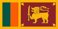
| Flag of Sri Lanka | |
Sri Lanka has a population of around 22 million (2020) and is a multinational state, home to diverse cultures, languages, and ethnicities. The Sinhalese are the majority of the nation's population. The Tamils, who are a large minority group, have also played an influential role in the island's history. Other long established groups include the Moors, the Burghers, the Malays, the Chinese, and the indigenous Vedda.
Currency / Language
| ISO | Currency | Symbol | Significant figures |
|---|---|---|---|
| LKR | Sri Lankan rupee | Rs රු or ரூ | 2 |
| ISO | Language |
|---|---|
| EN | English language |
| SI | Sinhala language |
| TA | Tamil language |


